Forecast Africa› Southern Africa›Eswatini

FORECAST ESWATINI
Four climate belts in 130 kilometres
Conditions right now
Mbabane
Reading…
6 places
The country
EQUIRECTANGULAR, FITTED TO ITS OWN BOXRED · CAPITAL GREEN · FORECAST PLACE BROWN · PRIMARY HIGHWAYS CLICK A DOT TO READ IT
The numbers
What the weather here is
Eswatini is small enough to cross in two hours and does four distinct climate zones on the way: the Highveld around Mbabane at 1,200 m, cool and taking around 1,200 mm; the Middleveld; the Lowveld toward Big Bend, subtropical, hot and under 600 mm; and the Lubombo ridge on the Mozambique border catching a little more again. Rain is summer convection from October to March, the winters are dry, and the Lowveld's drought exposure is the country's persistent agricultural problem — it is on the same rainfall gradient as the Limpopo lowveld next door.
Where the official forecast is
This site is not a warning service. The official forecast and every watch and warning for Eswatini comes from Eswatini Meteorological Service. During a tropical cyclone the advisory that everything else follows is RSMC La Réunion’s, which is the WMO centre for the southwest Indian Ocean.
What is on this page is the raw observation — the METAR itself, from the aerodrome named above it — with nothing added and nothing forecast.
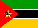 Mozambique
 South Africa